Matterport vs. LiDAR vs. drone: which 3D capture do you actually need?
Buyers usually come in asking for "a 3D scan" or "a digital twin." Those phrases cover three completely different capture methods, each with a different price tag, accuracy spec, deliverable shape, and use case. Picking the wrong one is the most common way budget gets wasted on this work.
This guide breaks down the three dominant capture methods in tristate work today: Matterport-style photogrammetry, terrestrial LiDAR, and aerial drone capture. The right pick depends less on what is trendiest and more on what you are actually trying to do with the result. Skip to the buyer-scenario list at the bottom if you want the quick answer.
Matterport (photogrammetry)
A stationary camera spins to capture overlapping 360-degree images. Software stitches them into a navigable 3D walkthrough that a viewer can move through with a mouse, phone, or VR headset. Accuracy holds within roughly one to two inches on dimensions, which is good enough for spatial understanding and most operational use cases. It is not survey-grade.
Deliverables typically include a web-hosted virtual tour, a floor plan PDF, and basic measurement tools. The whole thing is built to be shared as a link.
- Strong for. vacant office leasing, listing-grade real estate, healthcare facility orientation, insurance claim documentation, sales asset for the marketing team
- Weak for. anything requiring sub-inch accuracy, CAD or Revit deliverables, large outdoor or open spaces
Terrestrial LiDAR (laser scanning)
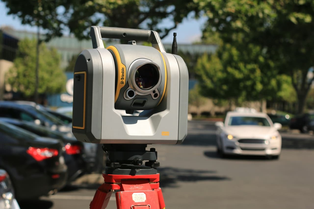
A tripod-mounted laser captures millions of points per second, producing a survey-grade 3D point cloud. Accuracy lands around 2 to 4 millimeters in typical conditions. The output is a dense, measurable dataset that downstream teams can open in CAD, Revit, Navisworks, or any other engineering platform.
Deliverables include the point cloud itself (.e57, .rcp, .rcs are the common formats), CAD overlays, and optional Revit-ready models when paired with scan-to-BIM modeling work. The point cloud is the artifact; everything else is built on top of it.
- Strong for. renovation as-builts, MEP coordination, industrial layout planning, historic documentation, anything an architect or engineer will open in CAD
- Weak for. marketing or leasing tours where Matterport is faster and cheaper, very small jobs where the field time is overkill
Aerial drone (photogrammetry and LiDAR variants)
A drone flies a programmed pattern carrying either a camera (photogrammetry) or a LiDAR sensor. Software stitches the captured imagery into a 3D model of the exterior. Photogrammetry holds accuracy in the few-centimeter range; drone-borne LiDAR pushes that down toward sub-decimeter.
Deliverables include site models, orthomosaic images, time-series progress photos, and volumetric measurements for stockpiles and earthworks.
- Strong for. active construction monitoring, rooftop inspections, site logistics planning, stockpile volume tracking, exterior heritage documentation
- Weak for. anything indoors, anything requiring interior detail, regulated airspace where flight permissions are not straightforward
Accuracy reality check (do not pay for what you do not need)
The biggest budget mistake on these projects is paying for LiDAR-grade accuracy on a project that only needs spatial understanding. If nobody downstream is loading the data into Revit, filing the model with a building department, or fabricating from the measurements, Matterport's spatial accuracy is almost always enough. It also delivers faster and shares easier.
The opposite mistake is rarer but more painful: relying on a Matterport scan for an as-built drawing or a re-rack engineering plan. The numbers will not survive scrutiny when the architect overlays them in CAD. If a precision engineer is going to open the file, LiDAR is the right capture from the start. Re-capturing later costs more than capturing correctly the first time.
Relative cost framing
Matterport is the cheapest of the three by a wide margin at equivalent scope. A small commercial space is often a single-day, single-operator job. Most buyers are surprised at how affordable a small twin actually is.
Terrestrial LiDAR typically runs 2 to 3 times Matterport at equivalent scope. The equipment is more expensive, the field time is longer, and the registration and quality-control work between fieldwork and delivery is meaningful. The premium buys accuracy and downstream flexibility, not field-time efficiency.
Drone capture is wildly use-case-dependent. A single drone flight on a small site can be cheaper than any indoor scan. A recurring multi-month construction monitoring contract is its own pricing animal, structured around frequency rather than scope.
Every quote on this site routes through a real conversation. Most projects land in a predictable range once we know the square footage, the deliverable, and the urgency. Send the basics and we will scope it.
Time onsite
Each capture method has a different field-time profile, and it matters for scheduling around active operations.
- Matterport. small commercial space (under 10,000 sqft), half a day. 50,000 sqft warehouse, one to two days. Hospital department, a few hours per unit, scheduled around clinical activity.
- LiDAR. small space, a full day. Mid-size warehouse, two to four days, plus comparable office time for registration and QC. Engineering-grade scans run longer because the QC pass is non-trivial.
- Drone. most fly-overs are under an hour once onsite. Weather is the largest variable. Recurring monitoring stacks weekly visits, each one short.
Buyer scenarios (the practical breakdown)
Most clients arrive with a specific use case in mind. The capture method falls out of the use case more cleanly than buyers expect.
- Leasing a vacant office and want a tour for prospective tenants. Matterport
- Planning a renovation and your architect needs an as-built. LiDAR
- Tracking progress on an active construction site over the next several months. drone, on a recurring schedule
- Insurance claim filed against your property and you need to document the loss. Matterport
- Warehouse re-rack or capacity audit, with engineering team involvement. LiDAR (sometimes Matterport if the precision bar is low)
- Filing for landmark designation on a historic building. LiDAR, often HABS-grade if grant-funded
- Hospital onboarding for new staff or traveling clinicians. Matterport
- Pre-incident plan for a commercial property. Matterport or LiDAR depending on whether the plan needs measured floor plates or a navigable walkthrough
- Public-safety agency mapping municipal buildings or private schools. depends on the deliverable; LiDAR for measured plans, Matterport for tactical orientation
- Insurance baseline for a historic interior, hotel, or high-value retail. Matterport, captured pre-loss and shelved until needed
Common mistakes buyers make
Four patterns show up often enough that they are worth naming.
- Asking for a "digital twin" without defining what it is twinning. The phrase is vendor marketing more than a technical spec. The right question is what outcome you want from the data, which drives the right capture.
- Specifying technology before specifying deliverable. The right question is what file the architect, insurer, or facility team needs to open. The scanner brand falls out of that, not the other way around.
- Sourcing on price alone. The cheapest scan is the one that does not get used. Cheaper Matterport-grade work that someone actually shares around the team is almost always better ROI than expensive LiDAR that sits in a Dropbox folder unopened.
- Forgetting the time dimension. A one-shot scan is a snapshot. If the space changes (active construction, retrofit, growing inventory), the value is in re-scans, not the first capture.
How a quote works
We start by asking what the data is for, not which technology to use. Tell us the deliverable downstream, a Matterport tour you will share with leasing prospects, a Revit-ready point cloud for your architect, a weekly drone overhead, and we will spec the right capture and turn around a quote.
For specialty work (historic, public safety, federal contracting), we loop in a specialist on the call. The lead site handles intake; the right pro handles the scan. Send the basics through the contact form and we will go from there.